Did you know that there had been a Great Black Swamp southwest of Lake Erie? In 1813 a soldier had written that his “comrades slogged through water six inches deep, underlain by ice. Often the ice broke, dropping them neck-deep in the swamp.” Can you even imagine being stuck in the muck up to your neck? Who had tamed The Great Black Swamp? Join Chuck and I as we investigate General William Hull and his marvel of engineering, a 200 mile road, a life-line for our new nation, taming The Great Black Swamp. Will we find evidence of this 200 year old corduroy road?
The Great Black Swamp
As the glaciers had melted over this flat land 12,000 years ago, they had left a thin layer of clay which had trapped moisture. This area had once been a lake bed, which had left the soggy muck, known as “The Great Black Swamp.”
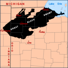
The Anishinaabe had avoided this land, where “water filled your footsteps,” and settled around the perimeter of the area along the four nearby rivers: the Maumee, the Portage, the Auglaize and the Sandusky.
This tragic landscape had taken many lives. Some had succumbed when they’d become ensnared in the webbing of branches woven tightly at ground level and their bodies had gotten stuck in the dense mud. Most deaths, however, had been from mosquitos when people had contracted Malaria.
General William Hull
The taming of The Great Black Swamp had started with Lieutenant-Colonel William Hull, who had proven his bravery during the Revolutionary War. Hull had fought in several battles: Trenton, Saratoga, Stony Point. Later in Boston, Hull had famously stated, “I only regret that I have but one life to lose for my country.”
President Thomas Jefferson had assigned Lieutenant-Colonel William Hull to be Governor and Indian Agent of the Michigan Territory in 1789.
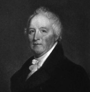
By Rembrandt Peale
Photo Credit: Michigan History of the Upper Great Lakes
In the 1790’s the residents of this region had been Anishinaabe: Ottawa, Wyandot, Potawatomi and Chippewa. The only military sites in the area had been Fort Detroit and Fort Mackinac. Some efforts had been made to continue a peaceful existence between the Anishinaabe and the newly formed United States government.
The Northwest Territory
It had been 1794 when General Anthony Wayne had defeated the local tribes, which had opened the Northwest Territory to European pioneers. As a consolation to the Anishinaabe, they had been given a region “free of white men’s invasion,” which had included The Great Black Swamp. Needless to say, The Great Black Swamp had remained uninhabitable. So, the Anishinaabe had been forced to squeezed their tribal communities into smaller areas along the perimeter of the swamp.
The Treaty of Detroit
By 1803 Ohio had achieved statehood while Michigan had remained a territory headed by Governor Hull. Across the Northwest region there had been continued unrest between the Anishinaabe tribes and the white settlers. A compromise had needed to be reached.
The goal of the November 17, 1807 “Treaty of Detroit” had been to bring renewed peace between the settlers and the Anishinaabe throughout Ohio and the “thumb” region of Michigan. However, European settlers had continued to push their boundaries into native areas, taking additional land. Governor Hull had never held these pioneers accountable. As a result, tensions from the tribes had simmered to a rolling boil.
The Treaty of Brownstone
William Hull continued negotiations with the Wyandot tribes as he’d realized the vital logistics of a
re-supply route needed for Fort Detroit. The waterways of the time had been dominated by the British, so a land route had been necessary.
The Treaty of Brownstone had been drawn in 1808 for a roadway to be built from Detroit to the Maumee River, hoping to continue south into Ohio. The survey had been completed in 1809 and congress had authorized the construction of this road through The Great Black Swamp. The Wyandot’s eyes had been opened with frustration as this proposed roadway would cut through two of their newly settled villages. So the road construction had been put on hold. . . for a couple of years.
The War of 1812
By 1812, the British had control of the Great Lakes waterways and had planned a land invasion by way of Canada. The native tribes had readily taken up arms alongside the British.
With a war on the horizon the United States Government had reinstated Governor Hull into the military with the rank of General.
General Hull had known that Fort Detroit and Fort Mackinac would need to be defended from the Red Coats and Natives. How would they re-supply Fort Detroit? These logistics would be vital to the war effort. Well, he needed to build the roadway through The Great Black Swamp!
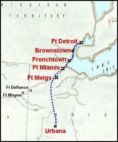
Hull’s Trace
General William Hull had traveled south to Ohio to rally his troops and prepare to defend Fort Detroit. But, there hadn’t been a direct road from Urbana, Ohio to Fort Detroit, Michigan. So he enlisted these men to begin building a corduroy road, our very first interstate.
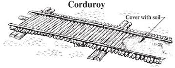
then covering the logs with dirt. Due to the swamp,
this road had needed to be several layers thick in many places along the route.
These men had labored an entire month in thigh-deep mud. Their horses and carts would need to be freed regularly from the gripping muck. At night mosquitos would hungrily suck blood while ankle-deep mud would seep into the floor of their tents.
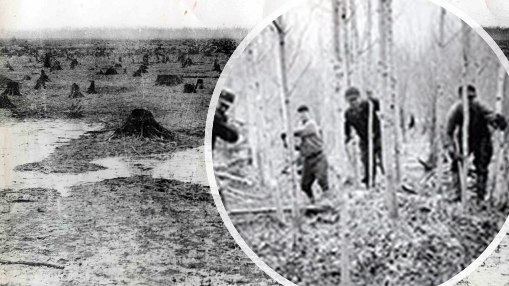
as well as arborvitae, tall slender bushes.
Death In The Swamp
Elias Darnell, one soldier, had written in his journal on December 24, 1812, after Hull had surrendered to the British without a single shot being fired, he referred to ‘staying in the swamp killed more of his comrades than an intense battle.’

of the Maumee City Express.
Finally Reaching The Maumee River
After working over a month creating this one hundred mile corduroy road, the men had reached the northern edge of The Great Black Swamp. Stretching before them, the Maumee River, where the men had bathed for an entire day.

when they’d reached the refreshing water of the Maumee River!
The Michigan Militia
Simultaneously in the early summer of 1812 under General Hull’s direction, Captain Herbert Lacroix’s Company of the Michigan Militia had begun building a road from Fort Detroit heading south along Lake Erie’s western shore. They had accomplished the feat of building one hundred miles of road.
Completing Hull’s Trace
Using the previous surveys, the two groups had met at The Huron River. There they had been able join together the northern section to the southern. Each road had been one hundred miles in length.
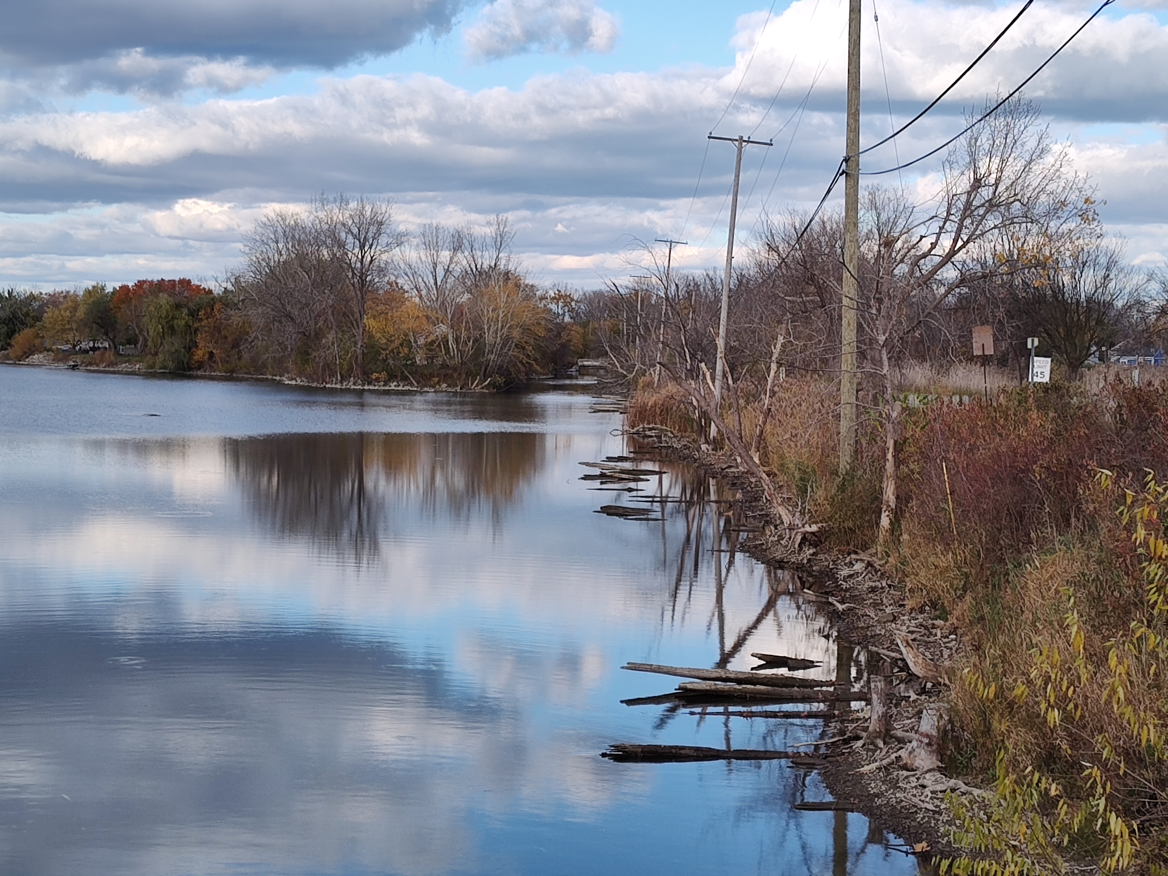
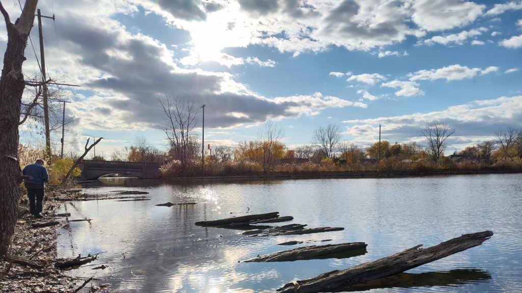
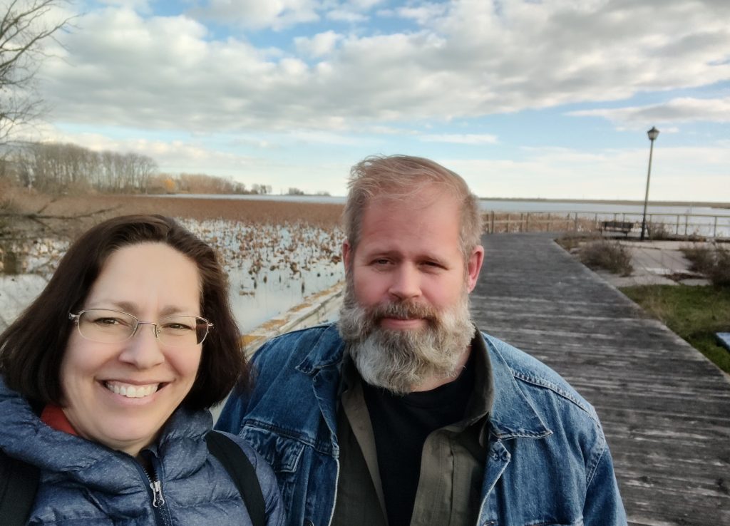
In our search for evidence of this 200 year old road, we parked at a nearby marina. Chuck leapt over the guardrail and down the bank, “I think . . . Yes! These logs are the remnants of their road.” He stated with a sense of awe. “Today we can see how amazing it was that they built this 200 mile road in just one month.” Chuck spoke into his video camera, “But here’s the crazy thing. You can still see the logs from the original road, two hundred years ago.” Chuck had added, “This had been Michigan’s first interstate.”
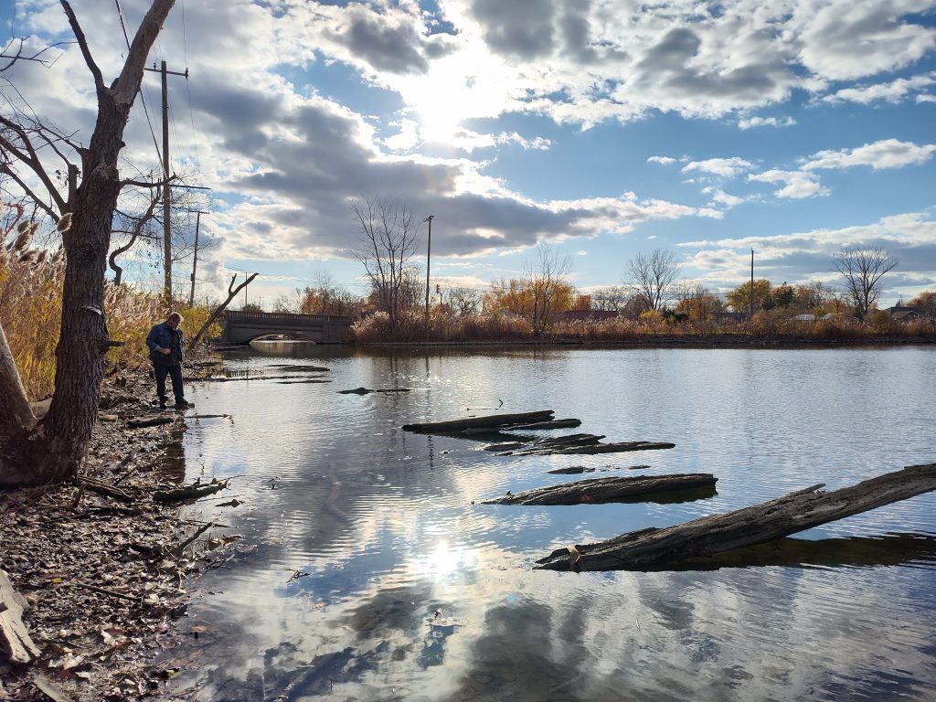
“It’s still here.” I chimed as I watched my footing down the embankment. “I can’t believe how they’d constructed this without cranes or chainsaws. They did it all with hand tools and horses. It’s amazing!”
1812 Battles
On August 16, 1812 General Hull had surrendered Fort Detroit to the mass of 1,800 British troops. This nearly bloodless siege, seven had been killed, had been met with criticism over the years. Even though just a month earlier, Brigadier-General William Hull had led an attack across the Detroit River capturing the Canadian town, Sandwich. Hull’s siege against Britain had been the first notable attack since war had been declared in June 1812.
The major land battles in The War of 1812 had been fought along Hull’s Trace. Thousands of soldiers have marched along this log road.
Hull’s Trace History
Later, this path had witnessed the forced relocation of the Anishinaabe.
During the industrial age this roadway had become part of the Dixie Highway hosting migrants from the south who had been seeking employment in factories along Hull’s Trace and in Detroit.
“This road has been witness to most of our nation’s history.” Chuck had marveled. “Thanks to our YouTube subscriber, Rob Squires, who’d made this suggestion.”
Ponderings
Finding evidence of Hull’s Trace had given me a sense of dipping my toes into history. This road had been the first interstate and permitted westward expansion into the Northwest Territory. Today we still use the same path that had tamed The Great Black Swamp. I feel it’s important to remember those who’ve come before us and appreciate their efforts to improve the lives of others.
Related Links:
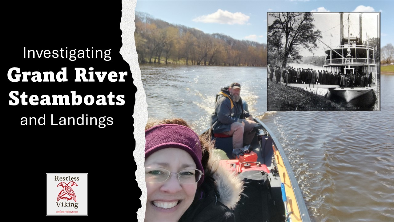
Check out our video of The Great Black Swamp!
Restless Viking merchandise is available!
Resources:
Rob Squires – suggested we look into Hull’s Trace
PBS Documentary “The Great Black Swamp”
Hull’s Trace article by The National Parks Service
New Bremen History article
The Great Black Swamp article
William Hull Article Michigan Technological University
The Great Black Swamp YouTube 2014 Toledo Water Crisis by Franklin Park Mall


